
Citizenship Test: Nunavut Territory Guide
Study Nunavut for the citizenship test: capital Iqaluit, the newest territory created in 1999, Inuit majority, Inuktitut, Arctic life and practice questions.
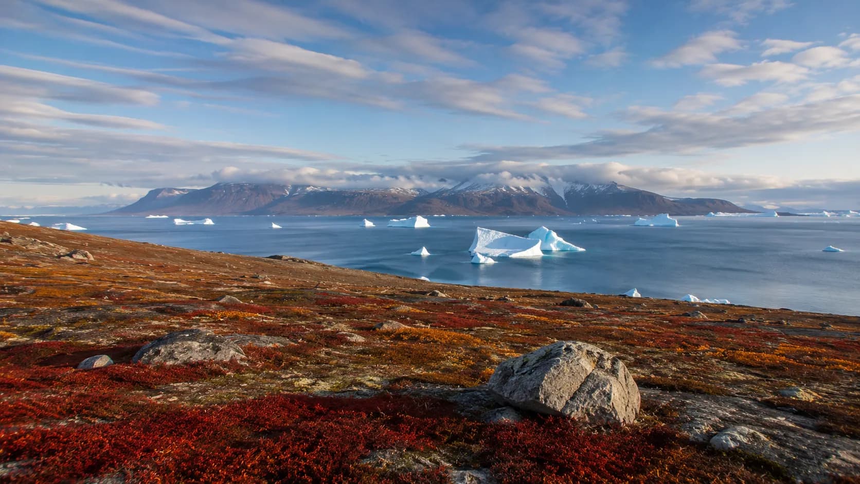
Nunavut is a northern territory, not a province, whose capital is Iqaluit, and it was created on April 1, 1999. For the citizenship test, remember that Nunavut is the newest territory, it is home to a majority Inuit population, and it was carved out of the eastern Northwest Territories. Its name means "our land" in Inuktitut, which sums up why it exists.
Territory, not a province
Nunavut is one of Canada's three territories, together with Yukon and the Northwest Territories. Territories are governed differently from provinces, drawing more of their powers from the federal government. Nunavut is also the newest of all the provinces and territories, which makes it easy to remember.
What makes a territory different from a province
A province holds its powers under the Constitution Act of 1867; a territory exercises powers that Parliament has handed to it by law. Day to day, Nunavut looks a lot like a province: it has an elected Legislative Assembly in Iqaluit, a premier and cabinet, and it runs its own schools, health services and housing. Like the Northwest Territories, Nunavut uses consensus government, with no political parties; members are elected as independents and choose the premier among themselves. The territory sends one member to the House of Commons and one senator to Ottawa.
Capital and region
Iqaluit is the capital of Nunavut, located on Baffin Island in the eastern Arctic, at the head of Frobisher Bay. It grew from an American air base built during the Second World War and was known as Frobisher Bay until 1987. The territory lies in Northern Canada and is the largest territory by area but the least populous, with communities spread across a huge Arctic expanse that includes most of Canada's Arctic islands.
A short history in five dates
- For thousands of years: the Inuit and their ancestors lived across the Arctic, hunting seals, whales and caribou and moving with the seasons.
- 1576: the English explorer Martin Frobisher reached the bay that now bears his name, near present-day Iqaluit, while searching for the Northwest Passage.
- 1870 and 1880: the Arctic mainland and then the Arctic islands came under Canadian control as part of the Northwest Territories.
- 1993: the Nunavut Land Claims Agreement, the largest Indigenous land claim settlement in Canadian history, was signed, and Parliament passed the law creating the new territory.
- April 1, 1999: Nunavut officially came into being, with Iqaluit as its capital.
How it was created
Nunavut was created on April 1, 1999, carved out of the eastern part of the Northwest Territories. It was established to give the Inuit self-government over their traditional homeland, and its creation is one of the most significant recent changes to Canada's map. The idea took decades: Inuit organizations began pressing for a homeland in the 1970s, residents of the Northwest Territories voted in favour of dividing the territory in 1982, and the land claim and the Nunavut Act followed in 1993.
This makes Nunavut a good example for the test of how Canada's territories can change over time, since it did not exist as a separate territory before 1999. It also shows that a public government, elected by everyone who lives there, can serve as a form of Indigenous self-government when the majority of the population is Inuit.
Geography and landscape
Nunavut is a land of Arctic tundra, with a cold climate, treeless plains and a long Arctic coastline. Because it is so vast and remote, many communities have no roads connecting them to one another, so people travel between them by air. The territory covers a large share of Canada's Arctic islands and mainland north, giving it enormous size but a very small, widely scattered population.
Baffin Island, where Iqaluit sits, is the largest island in Canada. Ellesmere Island, in the far north, reaches almost to the North Pole and hosts Alert, the northernmost permanently inhabited place in the world. The Northwest Passage, the sea route through the Arctic islands that explorers sought for centuries, winds through Nunavut's waters.
Climate and daily life in the North
Winter lasts most of the year, with deep cold, strong winds and, above the Arctic Circle, weeks of polar night when the sun never rises. Summer brings the midnight sun, when it never sets, and the tundra briefly turns green and full of flowers and birds. The sea ice that surrounds communities for much of the year is a highway for snowmobiles and dog teams, and for hunting seals and fish.
Everything that is not hunted or fished must be flown in or brought by ship during the short summer sealift, so groceries, fuel and building materials cost far more than in southern Canada. Housing is scarce, and the population is young and growing quickly. These realities make the cost of living a defining feature of life in Nunavut.
Communities beyond the capital
Nunavut has about twenty-five communities, all on the coast, and none connected to the others by road. Rankin Inlet, on the western shore of Hudson Bay, is the main centre of the Kivalliq region. Cambridge Bay, on Victoria Island, is the hub of the western Kitikmeot region and home to a federal Arctic research station. Arviat, Baker Lake, Pond Inlet and Pangnirtung are among the larger communities, while Grise Fiord, on Ellesmere Island, is the northernmost civilian community in Canada.
People, culture and language
The majority of people in Nunavut are Inuit, and the territory reflects Inuit culture in daily life, government and place names. Inuktitut is an official language of the territory, used alongside English and French, and Inuinnaqtun is recognized in the western communities. Inuktitut is written in both a syllabic script and the Roman alphabet, and it is the language of instruction in the early school years in many communities.
Inuit culture is visible everywhere: the inukshuk, a stone figure used as a landmark, appears on the territorial flag; carving and printmaking from communities such as Cape Dorset, now Kinngait, are known around the world; and throat singing, drum dancing and traditional knowledge, called Inuit Qaujimajatuqangit, guide public life. Nunavut was created specifically so the Inuit could govern their own homeland, which makes its story central to understanding Indigenous self-government in Canada. You can explore these themes further with the chapter quizzes.
Practice questions
- What is the capital of Nunavut? (a) Yellowknife (b) Whitehorse (c) Iqaluit (d) Rankin Inlet. Answer: (c). Iqaluit, on Baffin Island, is the capital; Yellowknife and Whitehorse are the other two territorial capitals.
- In what year was Nunavut created? (a) 1949 (b) 1970 (c) 1982 (d) 1999. Answer: (d). Nunavut came into being on April 1, 1999; 1949 is when Newfoundland joined Canada.
- True or false: Nunavut is the newest province of Canada. Answer: false. It is the newest territory, not a province.
- Which people form the majority of Nunavut's population? (a) Dene (b) Inuit (c) Metis (d) Cree. Answer: (b). Most residents are Inuit, and the territory was created for Inuit self-government.
- What does the name Nunavut mean in Inuktitut? (a) our land (b) big lake (c) north wind (d) place of fish. Answer: (a). Nunavut means "our land."
- From which territory was Nunavut carved? (a) Yukon (b) Northwest Territories (c) Quebec (d) Manitoba. Answer: (b). It was created from the eastern Northwest Territories.
Common mistakes and mix-ups
- Calling Nunavut the newest province: Canada's newest province is Newfoundland and Labrador (1949). Nunavut is the newest territory (1999).
- Swapping Iqaluit with Yellowknife or Whitehorse: Iqaluit is in Nunavut, Yellowknife in the Northwest Territories and Whitehorse in Yukon.
- Confusing Inuit with First Nations: the Inuit are one of the three Indigenous peoples recognized in Canada, distinct from First Nations and Metis. The singular is Inuk.
- Assuming Nunavut can be reached by road: no highway connects it to the rest of Canada, and its communities are linked by air and by sea in summer.
- Mixing up 1993 and 1999: the land claim agreement and the Nunavut Act date from 1993; the territory itself began on April 1, 1999.
What the test may ask
For the citizenship test, be able to name Iqaluit as the capital, identify Nunavut as a territory created in 1999, and recall that most of its people are Inuit and that Inuktitut is an official language. Its status as the newest territory is a common test point. Everything the test asks comes from the official guide, Discover Canada, so keep its regions chapter close.
The official test has 20 questions with a pass mark of 15 (75%), taken in 45 minutes online. Regular timed practice helps this fresh material stick. Try a full practice exam to measure your readiness; the app is free and needs no signup.
Key facts recap
- Status: a territory, not a province, and the newest one
- Capital: Iqaluit, on Baffin Island
- Created: April 1, 1999, from the eastern Northwest Territories
- Name: means "our land" in Inuktitut
- Largest territory by area but the least populous
- Most people are Inuit; Inuktitut is an official language
- Arctic tundra; communities are reached only by air, or by sea in summer
- Created to give the Inuit self-government over their homeland
Keep these facts sharp with spaced review sessions so Nunavut's capital and 1999 creation date stay clear on test day.