Citizenship Test: Northwest Territories Guide
Study the Northwest Territories for the citizenship test: capital Yellowknife, a territory since 1870, diamonds, the Mackenzie River and practice questions.
The Northwest Territories is a northern territory, not a province, whose capital is Yellowknife, and its lands became part of Canada in 1870. Knowing that it is a territory rather than a province is the key distinction for the citizenship test, along with its capital and its northern location. The territory's history explains most of Canada's northern map, because Yukon, Alberta, Saskatchewan and Nunavut were all carved out of it.
Territory, not a province
Canada has ten provinces and three territories, and the Northwest Territories is one of the three territories, together with Yukon and Nunavut. Territories are governed a little differently from provinces: they receive more of their powers from the federal government rather than holding them directly under the Constitution. The test may check whether you can tell a territory from a province.
What makes a territory different from a province
A province holds its powers directly under the Constitution Act of 1867, which lists what provinces control, such as education, health care and natural resources. A territory gets its powers from laws passed by Parliament, which means Ottawa can, in principle, change them. In practice the territories now run most of their own affairs through elected legislative assemblies and a premier, much like a province, and each territory sends a member to the House of Commons and one senator to the Senate.
The Northwest Territories and Nunavut also share an unusual political system called consensus government. Members of the Legislative Assembly are elected as independents, without political parties, and they choose the premier and cabinet among themselves. This is different from every province and from Yukon, which uses party politics.
Capital and region
Yellowknife is the capital of the Northwest Territories, sitting on the northern shore of Great Slave Lake. It began as a gold mining camp in the 1930s and became the capital in 1967, when the territorial government moved north from Ottawa. The territory lies in Northern Canada, above most of the provinces, and stretches across a vast, thinly populated expanse of the country's north, from the Alberta and British Columbia borders up to the Arctic Ocean.
A short history in five dates
- 1789: the fur trader Alexander Mackenzie travelled the great river that now bears his name all the way to the Arctic Ocean, hoping to reach the Pacific.
- 1870: Canada acquired Rupert's Land and the North-Western Territory from the Hudson's Bay Company, three years after Confederation. This is the date to remember for the test.
- 1898: Yukon was split off as a separate territory during the Klondike Gold Rush.
- 1905: Alberta and Saskatchewan were created as provinces from the southern part of the territory.
- 1999: Nunavut was created from the eastern part, leaving the Northwest Territories with its present borders.
How it became part of Canada
The vast North-Western lands became part of Canada in 1870, only a few years after Confederation in 1867. At the time, the territory covered almost everything between Ontario and British Columbia and north to the Arctic. Manitoba was created as a small province in the same year, and the rest was administered from Ottawa for decades. Since then the territory has been reorganized several times, and its borders have shrunk as new territories and provinces were carved from it, including Nunavut in 1999.
Geography and landscape
The territory contains two of Canada's great natural landmarks: Great Slave Lake, the deepest lake in North America, and the Mackenzie River, the longest river in the country, which flows north from the lake to the Beaufort Sea. Great Bear Lake, farther north, is one of the largest lakes in the world. The landscape ranges from boreal forest in the south to Arctic tundra in the north, and the Mackenzie Mountains rise along the Yukon border, where Nahanni National Park protects deep canyons and a waterfall twice the height of Niagara.
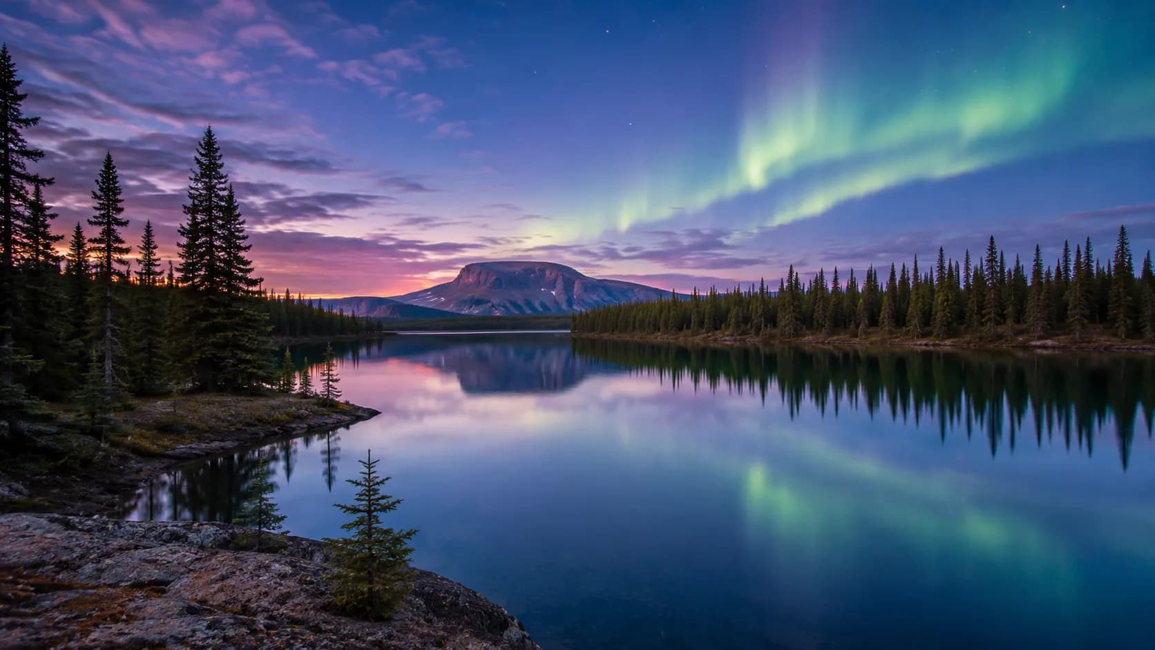
Because it sits so far north, the territory sees long summer days often called the midnight sun, and in winter the northern lights, or aurora, are a famous sight around Yellowknife. Its clear, dark skies draw visitors from around the world between late autumn and early spring.
Climate and daily life in the North
Winter is long and very cold, with Yellowknife regularly below minus 30 degrees Celsius in January, while summer is short but surprisingly warm and bright. Above the Arctic Circle, in places like Inuvik, the sun does not set for weeks in June and does not rise for weeks in December, a period known as the polar night.
Distance shapes everything. Many communities have no year-round road, so people and freight move by air, by barge on the Mackenzie River in summer, or by ice roads built across frozen lakes and rivers in winter. Groceries and fuel cost far more than in the south because of shipping, and that high cost of living is a common talking point about northern life. Hunting, fishing and trapping remain important both for food and for culture.
Communities beyond the capital
Roughly half of the territory's people live in Yellowknife, but the rest are spread across about thirty communities. Inuvik, in the Mackenzie Delta, is the main centre of the western Arctic and the end of the Dempster Highway from Yukon; a newer all-season road continues to Tuktoyaktuk on the Arctic coast. Hay River, on the south shore of Great Slave Lake, is the territory's transport hub, where the railway ends and river barges begin. Fort Smith, near the Alberta border, is the gateway to Wood Buffalo National Park, and Fort Simpson sits where the Liard River meets the Mackenzie.
Indigenous peoples, languages and culture
The Northwest Territories has a large Indigenous population, including Dene, Inuvialuit and Metis peoples. The Dene are First Nations peoples of the boreal forest and Mackenzie Valley, made up of several nations with their own languages. The Inuvialuit are the Inuit of the western Arctic, along the Beaufort Sea coast. The Metis descend from unions between First Nations people and European fur traders.
The territory recognizes eleven official languages, including English, French and nine Indigenous languages, which reflects the deep roots of these communities in the land. Several modern land claim and self-government agreements, such as the Inuvialuit agreement of 1984, give Indigenous peoples a direct say in how their lands and resources are used.
People, culture and economy
The modern economy is driven by diamond mining and gold, resources drawn from the northern rock. Gold built Yellowknife, and although its last gold mine closed in the early 2000s, the discovery of diamonds northeast of the city in the 1990s made Canada one of the world's leading diamond producers. Oil and gas, government jobs, tourism and traditional harvesting round out the economy. Building this context is easier with the chapter quizzes that group facts by theme.
Practice questions
- What is the capital of the Northwest Territories? (a) Whitehorse (b) Iqaluit (c) Yellowknife (d) Inuvik. Answer: (c). Whitehorse is the capital of Yukon and Iqaluit the capital of Nunavut.
- True or false: the Northwest Territories is a province. Answer: false. It is one of Canada's three territories.
- Which is the longest river in Canada? (a) the St. Lawrence (b) the Mackenzie (c) the Fraser (d) the Yukon. Answer: (b). The Mackenzie flows from Great Slave Lake to the Arctic Ocean.
- Which territory was created from the eastern Northwest Territories in 1999? (a) Yukon (b) Nunavut (c) Labrador (d) Manitoba. Answer: (b). Nunavut was created on April 1, 1999.
- When did the North-Western lands become part of Canada? (a) 1867 (b) 1870 (c) 1898 (d) 1949. Answer: (b). Canada acquired them in 1870, three years after Confederation.
- Which mineral made the Northwest Territories famous in recent decades? (a) coal (b) diamonds (c) potash (d) nickel. Answer: (b). Diamond mines opened northeast of Yellowknife in the 1990s.
Common mistakes and mix-ups
- Swapping the three territorial capitals: Yellowknife is in the Northwest Territories, Whitehorse in Yukon and Iqaluit in Nunavut. A memory trick: Yellowknife and Yukon both start with Y but do not go together.
- Calling it a province: it is a territory. If a question asks how many provinces Canada has, the answer is ten, and the Northwest Territories is not one of them.
- Confusing 1870 with 1999: 1870 is when the northern lands joined Canada; 1999 is when Nunavut was separated from the Northwest Territories.
- Writing Northwest Territory in the singular: the official name is plural, the Northwest Territories, often shortened to NWT.
- Thinking Great Slave Lake is the largest lake: it is the deepest in North America, but Great Bear Lake, also in the territory, is larger.
What the test may ask
For the citizenship test, be ready to name Yellowknife as the capital, to identify the Northwest Territories as a territory rather than a province, and to place it in Northern Canada. Questions on the three territories and their capitals are common, so knowing all three together helps. Everything the test asks comes from the official guide, Discover Canada, so read its regions chapter alongside this page.
The official test has 20 questions with a pass mark of 15 correct (75%), taken in 45 minutes online. Timed practice makes the northern geography easier to recall. Try a full practice exam to check your progress; the app is free and needs no signup.
Key facts recap
- Status: a territory, not a province
- Capital: Yellowknife, on Great Slave Lake
- Part of Canada since: 1870
- Region: Northern Canada
- Landmarks: Great Slave Lake and the Mackenzie River, Canada's longest river
- People: large Indigenous population, including Dene, Inuvialuit and Metis; eleven official languages
- Economy: diamond mining and gold
- Nunavut was separated from it in 1999
Lock these in with spaced review sessions so the three territories and their capitals stay clear in your memory.